Thursday, 7 December 2017

Lichen Hill


Just outside Alexander Bay is a small hill - sticking out in orange among the dull greys, browns and whites of the sand and stone in the southern Namib desert. Passers-by will usually just keep on going, not knowing the uniqueness that lies hidden there. To be absolutely honest, there is no place like that anywhere in the whole wide world...


Although the hill seems orange in colour, there are actually no flower-bearing plants on the hill. Every now and then you may see a few conophytums, lithops or other desert plants, but the majority of the hill is covered in a layer of rod-like structures – 10cm thick. Laymen will be excused thinking of these structures as plants, strictly speaking these are neither plants nor animals. These are lichens.  They are symbionts, composed of microscopic algae and fungi. Fungi do not have chlorophyll and do not photosynthesize to produce their own food. A lichen`s fungal part is thus fed by its photosynthesizing algal part. The algal part on the other hand benefits from the association because the fungus are better in finding, soaking up and retaining water and nutrients than they are.  The fungus also provide the resulting lichen shape and the reproductive structures. This type of symbiosis where two organisms live together in synchronised harmony to the benefit of both, is called mutuality. 


What makes the 50ha hillock near Alexander Bay so singular is the diversity and density of the lichen species. As stated by a survey more than 30 different lichen species exist here.


The most probable reason for this is the offshore sea fog. Even though lichens are found mainly in desert-like environments, they cannot live without water. The warm inland at Alexander Bay causes regular strong sea breezes during the daytime, often bringing with it the offshore fog. And this seems to bring the ideal circumstances for lichens to flourish.


Bird life under pressure


For decades the wetlands of the Orange river mouth were forbidden areas to the public. The strict security measures characterizing Alexander Bay have since become less tense. The security offices and boom across the road is still there, but we do not have to sign in anymore as was still the case in January 2016.

To reach the mouth you are better of with a 4x4 or a vehicle with high ground clearance. The road to the mouth is bumpy at best and presents interesting challenges all the way.

Obviously the river mouth doesn't look like it did when the first Portuguese ships went sailing past. Unfortunately we do not have much information about the natural state of the river in the years gone by, and we could not be witness to the degradation of the river during the time of inaccessibility. The river must have been a sublime sight before mankind entered the picture...


Dams in the river, mining and farming activities have dramatically taken their pounds of flesh. The river's water-levels are low, we cannot see the different seasonal levels any more. Several sandbanks in the river mouth prevent the sea from pushing in the necessary saltwater during high water or spring tides, the wetlands do not have the estuarine characteristics from before. The system is dominated primarily by fresh water. The result is less food for the water-birds which visit our shores during the European and Asian winter months and which feed primarily on marine mollusk and invertebrates. The wetlands on which waders fed, are partly destroyed by erosion and the sediment of coarse sand during flood waters. The big floods like the one in 1988 clouded the sea at the mouth area to such an extent that many fish-eating birds were unable to locate their food in the turbid waters.

The massive pressure on the bird life in this protected Ramsar (www.ramsar.org) area, is proof enough of the quickening pace of degradation. In 1985 26 650 water birds (representing 57 species) were counted here. By 2003 the numbers decreased by more or less 74%. And during CWAC (Coordinated Waterbird Counts) count in 2012 there were only 2 316 water birds left. Luckily the average lies near 6 500. Although the numbers seemed to be decreasing, the species count these days seems to be a constant 87.


Fortunately globally threatened species like Cape Cormorant, Damara Tern, Lesser Flamingo and Chestnut-banded Plover seem to have consistent numbers in this area.


In spite of all the above, the Orange river mouth is definitely worth a visit by any birder looking for that one little bird or lifer. Maybe one of the threatened species mentioned above, or maybe a Barlows Lark or Rosyfaced Lovebird. Vagrants like Bar-tailed Godwit, Red Knot and many others were also seen here. During one of our earlier visits to Alexander Bay we saw Fish Eagles, Ospreys, White Pelican and a variety of ducks. Then we aren't even talking about the number of gulls and terns!

Birding at the mouth is especially spectacular because of the fact that you'll probably be the only human in a radius of two kilometers. Particularly in the mornings... then it will only be you, the river, the sea, the mist and the screams of hundreds of gulls and terns looking for food...


Orange - the jugular of the Northern Cape


Just outside Alexander Bay we meet her again - an old friend!  The Orange River... jugular of the Northern Cape. The artery for the vineyards of Upington, Keimoes and Kakamas, thundering her way past Augrabies to Onseepkans. We know of her path past the missionary station at Pella, the small lucerne farms at Goodhouse, know her to be the bridge to wild adventure at Noordoewer and of the refreshment she brings to the Richersveld in summer when the mercury rises all the way past 50 degrees Celsius.  But never is the contrast between a river's course and her surroundings as stringent as here…


Down in the valley the water is winking at us, seamed by the only bit of green in the barren, grey and sandy earth - an oasis for the southern parts of the Namib desert. But it is here where the queen of the South African rivers is in agonizing deterioration! We know her to be bigger, broader, deeper and prouder than here where her path takes her between the formerly forbidden twin towns of Alexander Bay and Oranjemund. This is a 2 173 km-long wonderful gift, the fourth largest river in Africa, draining 45% of South Africa and we need her! The fact that she looks like this here, is testimony of the fact that 23 dams were built in her catchment area - water is life! A gift from God!


Every now and then she shows us her true majestic nature when she storms her way to the ocean through her floodplains - like she did in 1988 when a whopping 7 800 cubic meters (per second!) of water thundered its way down the Augrabies falls on the way to Alexander Bay. Luckily the river's gradient is quite low after passing through the falls, meaning it took days for the floodwaters to reach the twin towns. Leaving the locals just enough time to strengthen the southern river bank with the earth-moving machines of the mining companies nearby. The river took about one million tons of sediment from the north bank, sweeping it to the ocean and broadening her floodplain significantly. According to calculations, about 3,6 million tons of sand was pushed about 1,2 km into the ocean and dropped in a delta. It will most likely take a few years for the ocean to spread the sand along it shores.

In 1988 the flow of all these kiloliters of warmer fresh water from the Orange river into the colder ocean, could be followed by satellite imaging as it made its way south and along the shores of the Atlantic ocean. The results were catastrophic as it destroyed inter-tidal and shallow-water marine organisms such as mussels, urchins, limpets, red bait, rock lobster and kelp.

Large areas of the wetlands' flora were also destroyed, damaged by erosion or buried underneath tons of coarse sand - all because of these floods. Today species like Scirpus- and Sporobolus sedges, saltworts (Sarcocornia sp) and common reed (Phragmites australis) dominate the wetlands.

But the sad reality is that the majestic river is in bad shape, and this is not because of the flooding described above. This highly disturbed, modified ecological system is a result of years of degradation due to mining activities, flow regulation of the river and poor management of the river mouth. An estimated 40% of the river mouth is degraded or changed due to the cultivation of lucerne, mining activities, wind erosion, roads and sewage ponds. 


But the bad news doesn't stop here...

The rising demand for water for domestic, industrial and farming purposes in the Orange river's catchment area, puts the natural resource in the lower reaches of the river under immense pressure. The withdrawal and the regulating of water by the large number of dams in the river, has lowered the annual flow by half. If we build even one more dam in this river, the results will be catastrophic for the wetlands already struggling to survive at the river mouth. It could even lead to the river drying up periodically. Another problem is that the pollution by farmers, mines and other businesses along the river combined with the already lower water level increases the chemical and nutrient load of the river, which in turn encourages algal bloom.

The numbers of invasive or alien flora species like Mesquite Prosopis increased immensely after the 2011 floods; together with six other non-indigenous species they are considered a huge threat to the struggling wetlands.

Another threat is the pressure put on the sensitive area by the locals, for instance the catching of fish with gill nets, also the illegal hunting with dogs on the river banks and the poaching of ducks and geese. Stray dogs also cause problems on the islands and river banks, especially during the breeding time of various bird species. Quad bikes and other 4x4's, whose owners do not follow the existing roads and do not keep to the laws, are also responsible for substantial damage being done from time to time. 

Luckily for us, all is not lost...


In 1991 the wetlands here were declared a Ramsar area and in 2001 Alexcor, the diamond company owning big parts of the land surrounding Alexander Bay, promised to rehabilitate the area and restore the wetlands. "Working for Wetlands" has finished a few smaller rehabilitation projects by 2005. In 2013 Alexcor applied to be allowed to start certain rehabilitation projects and in 2014 the "Endangered Wildlife Trust" started monitoring the bird life and alien flora with their "Source to Sea Program".

Although the rehabilitation of the river, wetlands and coast will take a long time and most likely won't restore the area to its original state, aforementioned efforts are good news. And the efforts show a willingness to go in the right direction. We're cautiously optimistic for significant results... 

Alexander Bay... and now?

Team Jacobus has arrived safely in Alexander Bay. We thank the Lord for travel mercies.

From now on this is what you can expect on the blog:

1. Regular (almost daily) informative, scientific posts on the environment, nature, fauna, flora, animal activities and how the human manifests itself in all this.  This will be in English.

2. Regular (very regular) posts on the people we meet and places we go - this will be in Afrikaans and this will give the human touch to the story of "Footsteps to Good Hope".

3. Last but not least, the daily devotions Jacobus and his support team will read. These are also in Afrikaans. 

In this manner we hope to keep you all completely up to date.

So... from Alexander Bay we go... 

Good night.

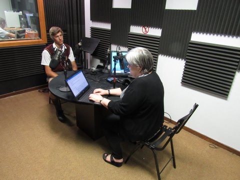
Another interview!

Join us on  RSG on Sunday 10 December @ 7:00 am for another radio interview - recorded by Lizelle de Bruin with Jacobus before we left.  This interview is part of the religious lifestyle program called "Sondagjoernaal".


Don't miss it!

(Oooh all right, if you DO happen to miss it, we will try and upload the Potgooi link later next week.)

Update... Are you excited?

Today we left for Alexander Bay. Around 8:54 we were in Citrusdal. The world is dry, the weather hot and the anticipation palpable...


So if you are counting:

16 hours and 36 minutes 

before we have take off. 

Nothing much we can do now but pray and have faith that all our planning, organising, thinking ahead, preparing and training will bear fruit and that we - Lord willing - will finish in 41 days in The Cape of Good Hope Nature Reserve... 977km later, stronger, tired, thankful, tearful and more aware than ever of our almighty Creator and loving Father.


Tuesday, 5 December 2017

It's all in the planning...

For almost a year Footsteps to Good Hope was in the planning phase. I am not sure what we are going to do with all the excess time we'll have on our hands as soon as this epic adventure is over!

What was there to plan?
Well, the route for starters.  How to get from Alexander Bay to Cape of Good Hope hiking along the coast? Where will Jacobus be permitted to walk freely and where will there be permits, permission and regulations applicable in the hiking? Restricted areas were a possible hurdle, high cliffs and dangerous tides could be a risk.  So this part of the planning took the longest and was the most intense and nerve wrecking. We literally finished the route planning yesterday evening at around 23:15! For every day of the hike, Jacobus will have maps and photos like these, spelling out everything from coordinates to little rivers and small hamlets.


Part of the planning was the food and water issue. With this Henriette had the help of one of our "old boys", or rather "old girls".  She is a third year BSc Dietician student and was more than willing to help with ideas and guidelines. Thanks, it was an experience to work on the same foot with one of our pupils of years ago. Enjoy your holiday and good luck with your final year!


The planning also revolved around gear, what to take, what will Jacobus really need and what are nice-to-haves. One of the most important things were the tracker and the possibility to have contact with Jacobus - by satellite and mobile: the latter was completely sorted out yesterday afternoon when we purchased a mobile phone with enough data and minutes to help us through. The number: +27 61 008 0935. Send him a message of encouragement.


Planning was also in the details of the projects (see an earlier post). In the finalising of his daily devotions in which Martin de Wit played an enormously important role. In the overnight accommodation of the support team. In getting everything in order for Maricia to join Jacobus from the 27th of December. In getting our T-shirts printed with the logo we mentioned in an earlier post.


So, it all started with a plan. And that plan took a lot of planning.  And now - Lord willing - we can put all these plans to action starting Friday 8th of December. Join us on Facebook and here on the blogspot - we plan to keep you posted!